


Weather
Blowing Dust advisory 041524 -2
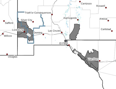 Southwest Desert/Lower Gila River Valley-Southeast Tularosa Basin-
Western El Paso County-Southern Hudspeth Highlands-Rio Grande
Valley of Eastern El Paso/Western Hudspeth Counties-Rio Grande
Valley of Eastern Hudspeth County-
Including the cities of Virden, Sierra Blanca, Tornillo, Downtown
El Paso, West El Paso, Lordsburg, Red Rock, Fort Hancock, Fabens,
Upper Valley, Indian Hot Springs, and Orogrande
Mon Apr 15 2024
Blowing Dust Advisory 041524 -1
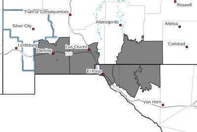 Southwest Desert/Mimbres Basin-Southern Dona Ana County/Mesilla
Valley-Otero Mesa-Eastern/Central El Paso County-Northern
Hudspeth Highlands/Hueco Mountains-Salt Basin-
Including the cities of Dell City, Deming, Sunland Park,
Columbus, Las Cruces, Socorro, Fort Bliss, Loma Linda, East and Northeast El Paso, Hueco Tanks, Salt Flat, Cornudas, Vado, and Crow Flats
Mon Apr 15 2024
...BLOWING DUST ADVISORY IN EFFECT UNTIL 5 PM MDT THIS AFTERNOON...
...HIGH WIND WARNING REMAINS IN EFFECT UNTIL 10 PM MDT THIS
EVENING...
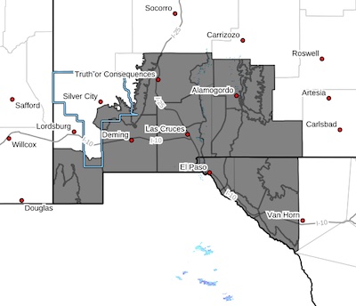
High Wind Warning -2-041524
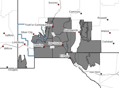 Southern Gila Foothills/Mimbres Valley-Uplands of the Bootheel-
Southwest Desert/Mimbres Basin-Eastern Black Range Foothills-
Sierra County Lakes-Northern Dona Ana County-Southern Dona Ana
County/Mesilla Valley-West Slopes Sacramento Mountains Below
7500 Feet-Sacramento Mountains Above 7500 Feet-East Slopes
Sacramento Mountains Below 7500 Feet-Otero Mesa-West Central Tularosa Basin/White Sands-
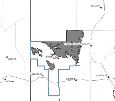
High Wind Warning 041524
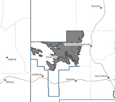 Central Grant County/Silver City Area-Southern Gila Region
Highlands/Black Range-
Including the cities of Lake Roberts, Kingston, Silver City,
Mimbres, and Fort Bayard
1226 PM MDT Sat Apr 13 2024
...HIGH WIND WARNING IN EFFECT FROM 1 PM TO 10 PM MDT MONDAY...
* WHAT...West winds 35 to 45 mph with gusts up to 60 mph with up to
70 MPH within the Black Range.
Wind Advisory -2 -041524
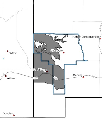 Upper Gila River Valley-Southwest Desert/Lower Gila River Valley-
Including the cities of Gila Hot Springs, Red Rock, Lordsburg,
Cliff, Buckhorn, Mule Creek, and Virden
1226 PM MDT Sat Apr 13 2024
...WIND ADVISORY IN EFFECT FROM 1 PM TO 10 PM MDT MONDAY...
* WHAT...West winds 30 to 40 mph with gusts up to 55 mph expected.
Fire Weather Watch 041524
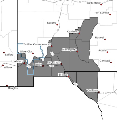 CRITICAL FIRE CONDITIONS EXPECTED MONDAY... .A strong upper low will be moving into the Four Corners region on Monday which will bring strong west to southwest winds to the Borderland. Winds gusting to 60 mph combined with minimum relative humidities in the single digits will lead to extremely critical fire weather conditions late Monday morning into the evening.
Southwest Deserts and Lowlands/Las Cruces BLM/GLZ-
South Central Lowlands and Southern Rio Grande Valley/BLM/GLZ-
Capitan and Sacramento Mountains/Lincoln NF/LNZ-
Texas Fire Weather Zone 055
El Paso County- Texas Fire Weather Zone 056
Hudspeth County-
High Wind Watch 041524
 Southern Gila Foothills/Mimbres Valley-Lowlands of the Bootheel-
Uplands of the Bootheel-Southwest Desert/Mimbres Basin-Eastern
Black Range Foothills-Sierra County Lakes-Northern Dona Ana
County-Southern Dona Ana County/Mesilla Valley-West Slopes
Sacramento Mountains Below 7500 Feet-Sacramento Mountains Above
7500 Feet-East Slopes Sacramento Mountains Below 7500 Feet-Otero
Mesa-West Central Tularosa Basin/White Sands-
Wind Advisory - 2- time and area extended 0405-040624
 Southern Gila Region Highlands/Black Range-
Including the cities of Kingston and Lake Roberts
949 PM MDT Thu Apr 4 2024
...WIND ADVISORY IN EFFECT FROM NOON FRIDAY TO 6 AM MDT SATURDAY...
...HIGH WIND WARNING NOW IN EFFECT FROM 6 AM TO 6 PM MDT SATURDAY...
* WHAT...For the Wind Advisory, southwest winds 30 to 40 mph with
gusts up to 55 mph expected. For the High Wind Warning, west winds
30 to 40 mph with gusts up to 60 mph expected.